Cirkit Designer Logo
Cirkit Designer
Your all-in-one circuit design IDE
Home / 
Component Documentation

How to Use LC76G Multi-GNSS Module: Examples, Pinouts, and Specs

Image of LC76G Multi-GNSS Module
Cirkit Designer LogoDesign with LC76G Multi-GNSS Module in Cirkit Designer

Introduction

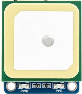
The LC76G Multi-GNSS Module, manufactured by Waveshare, is a compact, high-performance module designed for global navigation satellite system (GNSS) applications. It supports multiple satellite constellations, including GPS, GLONASS, Galileo, and BeiDou, enabling precise positioning and navigation. With its low power consumption and high sensitivity, the LC76G is ideal for a wide range of applications, such as vehicle tracking, wearable devices, drones, and IoT systems.

Explore Projects Built with LC76G Multi-GNSS Module

Use Cirkit Designer to design, explore, and prototype these projects online. Some projects support real-time simulation. Click "Open Project" to start designing instantly!
Cellular-Enabled IoT Device with Real-Time Clock and Power Management
Image of LRCM PHASE 2 BASIC: A project utilizing LC76G Multi-GNSS Module in a practical application
This circuit features a LilyGo-SIM7000G module for cellular communication and GPS functionality, interfaced with an RTC DS3231 for real-time clock capabilities. It includes voltage sensing through two voltage sensor modules, and uses an 8-channel opto-coupler for isolating different parts of the circuit. Power management is handled by a buck converter connected to a DC power source and batteries, with a fuse for protection and a rocker switch for on/off control. Additionally, there's an LED for indication purposes.
Cirkit Designer LogoOpen Project in Cirkit Designer
Arduino Nano Based GPS Tracker with GSM Communication and Accelerometer
Image of Circuit Aayush: A project utilizing LC76G Multi-GNSS Module in a practical application
This circuit is designed for communication and location tracking purposes. It features an Arduino Nano interfaced with a SIM800L GSM module for cellular connectivity, a GPS NEO 6M module for obtaining geographical coordinates, and an AITrip ADXL335 GY-61 accelerometer for motion sensing. The LM2596 Step Down Module is used to regulate the power supply to the components.
Cirkit Designer LogoOpen Project in Cirkit Designer
Arduino Nano-Based GPS and GSM Tracking System with Load Cell Integration
Image of load cell: A project utilizing LC76G Multi-GNSS Module in a practical application
This is a multi-functional circuit designed for location tracking, cellular communication, and weight measurement. It uses an Arduino Nano to interface with a GPS module, a GSM module, and a load cell with an HX711 amplifier, displaying data on an I2C LCD screen. Power is supplied by a Li-Ion battery through a buck converter, with a rocker switch for power control and a pushbutton for user input.
Cirkit Designer LogoOpen Project in Cirkit Designer
Satellite Compass and Network-Integrated GPS Data Processing System
Image of GPS 시스템 측정 구성도_241016: A project utilizing LC76G Multi-GNSS Module in a practical application
This circuit comprises a satellite compass, a mini PC, two GPS antennas, power supplies, a network switch, media converters, and an atomic rubidium clock. The satellite compass is powered by a triple output DC power supply and interfaces with an RS232 splitter for 1PPS signals. The mini PCs are connected to the USRP B200 devices via USB for data and power, and to media converters via Ethernet, which in turn connect to a network switch using fiber optic links. The antennas are connected to the USRP B200s through RF directional couplers, and the atomic clock provides a 1PPS input to the RS232 splitter.
Cirkit Designer LogoOpen Project in Cirkit Designer

Explore Projects Built with LC76G Multi-GNSS Module

Use Cirkit Designer to design, explore, and prototype these projects online. Some projects support real-time simulation. Click "Open Project" to start designing instantly!
Image of LRCM PHASE 2 BASIC: A project utilizing LC76G Multi-GNSS Module in a practical application
Cellular-Enabled IoT Device with Real-Time Clock and Power Management
This circuit features a LilyGo-SIM7000G module for cellular communication and GPS functionality, interfaced with an RTC DS3231 for real-time clock capabilities. It includes voltage sensing through two voltage sensor modules, and uses an 8-channel opto-coupler for isolating different parts of the circuit. Power management is handled by a buck converter connected to a DC power source and batteries, with a fuse for protection and a rocker switch for on/off control. Additionally, there's an LED for indication purposes.
Cirkit Designer LogoOpen Project in Cirkit Designer
Image of Circuit Aayush: A project utilizing LC76G Multi-GNSS Module in a practical application
Arduino Nano Based GPS Tracker with GSM Communication and Accelerometer
This circuit is designed for communication and location tracking purposes. It features an Arduino Nano interfaced with a SIM800L GSM module for cellular connectivity, a GPS NEO 6M module for obtaining geographical coordinates, and an AITrip ADXL335 GY-61 accelerometer for motion sensing. The LM2596 Step Down Module is used to regulate the power supply to the components.
Cirkit Designer LogoOpen Project in Cirkit Designer
Image of load cell: A project utilizing LC76G Multi-GNSS Module in a practical application
Arduino Nano-Based GPS and GSM Tracking System with Load Cell Integration
This is a multi-functional circuit designed for location tracking, cellular communication, and weight measurement. It uses an Arduino Nano to interface with a GPS module, a GSM module, and a load cell with an HX711 amplifier, displaying data on an I2C LCD screen. Power is supplied by a Li-Ion battery through a buck converter, with a rocker switch for power control and a pushbutton for user input.
Cirkit Designer LogoOpen Project in Cirkit Designer
Image of GPS 시스템 측정 구성도_241016: A project utilizing LC76G Multi-GNSS Module in a practical application
Satellite Compass and Network-Integrated GPS Data Processing System
This circuit comprises a satellite compass, a mini PC, two GPS antennas, power supplies, a network switch, media converters, and an atomic rubidium clock. The satellite compass is powered by a triple output DC power supply and interfaces with an RS232 splitter for 1PPS signals. The mini PCs are connected to the USRP B200 devices via USB for data and power, and to media converters via Ethernet, which in turn connect to a network switch using fiber optic links. The antennas are connected to the USRP B200s through RF directional couplers, and the atomic clock provides a 1PPS input to the RS232 splitter.
Cirkit Designer LogoOpen Project in Cirkit Designer

Common Applications and Use Cases

  • Vehicle Tracking Systems: Real-time location tracking for fleet management.
  • Wearable Devices: Fitness trackers and smartwatches for outdoor activities.
  • Drones and UAVs: Accurate navigation and positioning for autonomous flight.
  • IoT Devices: Location-based services in smart city and industrial IoT applications.
  • Geographic Surveying: High-precision mapping and surveying tasks.

Technical Specifications

Key Technical Details

Parameter Value
Manufacturer Waveshare
Part ID LC76G GNSS Module
GNSS Constellations GPS, GLONASS, Galileo, BeiDou
Channels 33 tracking channels, 99 acquisition channels
Positioning Accuracy 1.5 meters CEP (Circular Error Probable)
Cold Start Time < 35 seconds
Hot Start Time < 1 second
Update Rate 1 Hz (default), configurable up to 10 Hz
Operating Voltage 3.0V to 4.3V
Power Consumption 21 mA (tracking mode), 15 µA (standby mode)
Communication Interface UART (default baud rate: 9600 bps)
Operating Temperature -40°C to +85°C
Dimensions 10.1 mm × 9.7 mm × 2.2 mm

Pin Configuration and Descriptions

The LC76G module has a total of 12 pins. Below is the pinout and description:

Pin Number Pin Name Description
1 VCC Power supply input (3.0V to 4.3V).
2 GND Ground connection.
3 TXD UART transmit pin (data output).
4 RXD UART receive pin (data input).
5 PPS Pulse Per Second output for precise timing synchronization.
6 NC Not connected (leave unconnected).
7 NC Not connected (leave unconnected).
8 NC Not connected (leave unconnected).
9 NC Not connected (leave unconnected).
10 NC Not connected (leave unconnected).
11 NC Not connected (leave unconnected).
12 NC Not connected (leave unconnected).

Usage Instructions

How to Use the LC76G in a Circuit

  1. Power Supply: Connect the VCC pin to a regulated 3.3V power source and the GND pin to ground.
  2. UART Communication: Connect the TXD pin to the RX pin of your microcontroller and the RXD pin to the TX pin of your microcontroller.
  3. Antenna: Attach an active GNSS antenna to the module for optimal signal reception.
  4. PPS Signal: If precise timing is required, use the PPS pin to synchronize with an external clock or system.

Important Considerations and Best Practices

  • Antenna Placement: Ensure the GNSS antenna has a clear view of the sky for optimal satellite reception.
  • Power Supply: Use a stable and noise-free power source to avoid interference with GNSS signals.
  • UART Configuration: The default baud rate is 9600 bps. Configure your microcontroller's UART settings accordingly.
  • Firmware Updates: Check the manufacturer's website for firmware updates to improve performance and compatibility.

Example: Connecting LC76G to Arduino UNO

Below is an example of how to interface the LC76G module with an Arduino UNO and read GNSS data:

Circuit Connections

LC76G Pin Arduino UNO Pin
VCC 3.3V
GND GND
TXD Pin 10 (SoftwareSerial RX)
RXD Pin 11 (SoftwareSerial TX)

Arduino Code

#include <SoftwareSerial.h>

// Define SoftwareSerial pins for LC76G communication
SoftwareSerial GNSS(10, 11); // RX = Pin 10, TX = Pin 11

void setup() {
  Serial.begin(9600);        // Initialize Serial Monitor
  GNSS.begin(9600);          // Initialize GNSS module communication
  Serial.println("LC76G GNSS Module Test");
}

void loop() {
  // Check if data is available from the GNSS module
  while (GNSS.available()) {
    char c = GNSS.read();    // Read a character from the GNSS module
    Serial.print(c);         // Print the character to the Serial Monitor
  }
}

Troubleshooting and FAQs

Common Issues and Solutions

  1. No Data Output from the Module

    • Cause: Incorrect UART connections or baud rate mismatch.
    • Solution: Verify the TXD and RXD connections. Ensure the baud rate is set to 9600 bps.
  2. Poor Satellite Signal Reception

    • Cause: Obstructed antenna placement or interference.
    • Solution: Place the antenna in an open area with a clear view of the sky. Avoid placing it near electronic devices that may cause interference.
  3. Module Not Powering On

    • Cause: Insufficient or unstable power supply.
    • Solution: Ensure the power supply provides a stable voltage between 3.0V and 4.3V.
  4. PPS Signal Not Working

    • Cause: Incorrect configuration or firmware issue.
    • Solution: Verify the PPS pin connection and check for firmware updates.

FAQs

  • Q: Can the LC76G module operate indoors?
    A: While the module may work indoors, signal reception is significantly reduced. For best results, use the module outdoors or near a window.

  • Q: How many satellites can the LC76G track simultaneously?
    A: The module can track up to 33 satellites simultaneously.

  • Q: Can I increase the update rate beyond 1 Hz?
    A: Yes, the update rate is configurable up to 10 Hz. Refer to the manufacturer's documentation for configuration commands.

  • Q: Does the module support SBAS (Satellite-Based Augmentation Systems)?
    A: Yes, the LC76G supports SBAS for improved positioning accuracy.


This concludes the documentation for the LC76G Multi-GNSS Module. For further details, refer to the official Waveshare datasheet and user manual.