How to Use NEO-6M(GPS MODULE): Examples, Pinouts, and Specs
Introduction
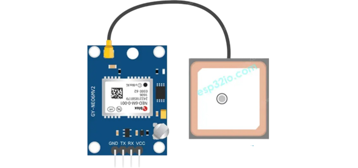
The NEO-6M GPS module is a compact, high-performance satellite positioning system receiver that provides a simple solution for integrating GPS functionality into various electronic projects. It is based on the u-blox NEO-6 series receiver chipset which is capable of tracking up to 50 satellites at a time and has a high level of sensitivity for improved accuracy. Common applications of the NEO-6M GPS module include drones, vehicle tracking systems, personal navigation devices, and time synchronization.
Explore Projects Built with NEO-6M(GPS MODULE)

Explore Projects Built with NEO-6M(GPS MODULE)
Technical Specifications
Key Technical Details
- Receiver Type: 50 Channels, GPS L1 frequency, C/A Code
- Position Accuracy: 2.5 meters Autonomous
- Update Rate: Up to 5 Hz
- Acquisition Times: Cold starts: 27s, Aided starts: 3s, Reacquisition: 1s
- Sensitivity Tracking & Navigation: –161 dBm
- Operating Temperature: –40 °C to 85 °C
- Supply Voltage: 3.0V to 5.5V
- Power Consumption: 50mA at 5V
Pin Configuration and Descriptions
| Pin Number | Pin Name | Description |
|---|---|---|
| 1 | VCC | Power supply (3.0V to 5.5V) |
| 2 | GND | Ground |
| 3 | TX | Transmit data out (TTL level) |
| 4 | RX | Receive data in (TTL level) |
| 5 | PPS | Pulse per second output |
Usage Instructions
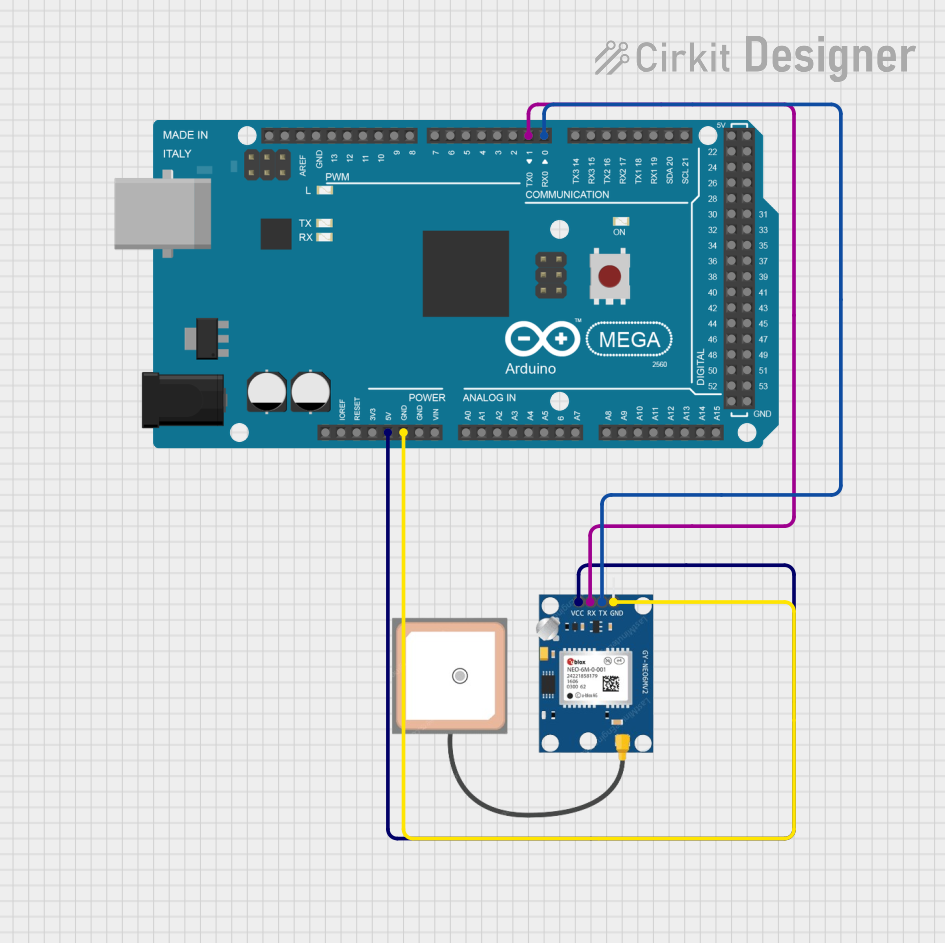
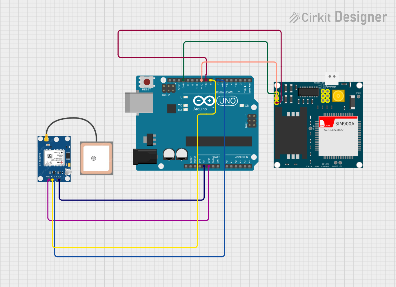
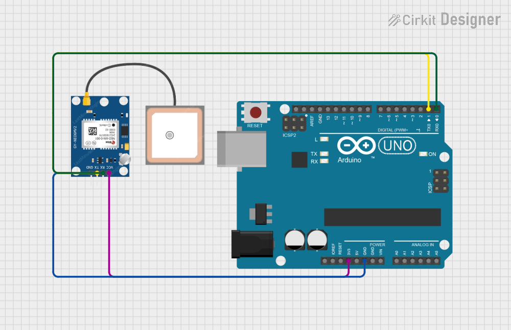
Integration into a Circuit
- Power Connection: Connect the VCC pin to a 3.0V to 5.5V power supply and the GND pin to the ground of your system.
- Data Communication: Connect the TX pin of the NEO-6M to the RX pin of your microcontroller and the RX pin of the NEO-6M to the TX pin of your microcontroller.
- PPS Output: The PPS pin outputs a pulse per second which can be used for precise timing applications. This is optional and can be left unconnected if not required.
Important Considerations and Best Practices
- Ensure that the power supply is stable and within the specified voltage range.
- Place the GPS module with a clear view of the sky for optimal satellite signal reception.
- Use proper ESD precautions when handling the NEO-6M GPS module.
- For better accuracy, allow the module to warm up and acquire satellites before taking readings.
Example Code for Arduino UNO
#include <SoftwareSerial.h>

// The NEO-6M TX pin is connected to Arduino pin 4 (RX)
// The NEO-6M RX pin is connected to Arduino pin 3 (TX)
SoftwareSerial gpsSerial(4, 3); // RX, TX

void setup() {
  // Start the serial communication with the host computer
  Serial.begin(9600);
  while (!Serial) {
    ; // Wait for serial port to connect
  }

  // Start the serial communication with the GPS module
  gpsSerial.begin(9600);
}

void loop() {
  // Check if data is available to read from the GPS module
  if (gpsSerial.available()) {
    // Read the data from the GPS module
    char c = gpsSerial.read();
    // Send the data to the host computer
    Serial.write(c);
  }
}
Troubleshooting and FAQs
Common Issues
- No Data Output: Ensure that the wiring is correct and the module has a clear view of the sky. Check the baud rate settings.
- Inaccurate Position: Wait for the module to get a stable fix on the satellites. This can take several minutes.
- Intermittent Signal: Avoid placing the module near devices that emit RF noise. Ensure the antenna has a clear view of the sky.
Solutions and Tips for Troubleshooting
- Power Supply Issues: Verify that the power supply is within the specified range and is stable.
- Antenna Placement: Place the antenna in a location with minimal obstructions to the sky.
- Cold Start: If the module has been off for a long time, it may take longer to acquire a fix. Be patient during this process.
FAQs
Q: How can I increase the update rate of the GPS module? A: The update rate can be configured using u-blox software tools. However, increasing the update rate may affect the accuracy.
Q: Can I use the NEO-6M GPS module indoors? A: GPS signals are weak indoors and may not be sufficient for the module to get a fix. It's recommended to use the module outdoors or near a window.
Q: What is the purpose of the PPS pin? A: The PPS pin outputs a pulse per second which can be used for precise timing applications, such as time synchronization.
Q: How do I interpret the data output from the GPS module? A: The data output is in the NMEA format, which is a standard protocol for GPS information. You can parse this data to extract the required information such as latitude, longitude, and time.