How to Use L76K GPS HAT: Examples, Pinouts, and Specs
Introduction
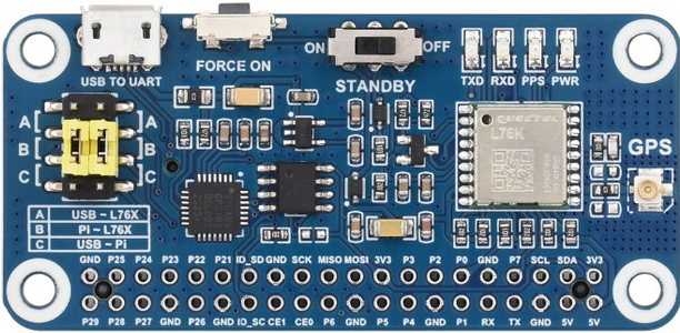
The L76K GPS HAT by Waveshare is a GPS module designed specifically for Raspberry Pi. It features the L76K chip, which delivers high-accuracy positioning data and supports multiple satellite navigation systems, including GPS, GLONASS, Galileo, and BeiDou. This module is ideal for applications requiring precise location tracking, such as navigation systems, IoT projects, and geofencing solutions.
Explore Projects Built with L76K GPS HAT


Explore Projects Built with L76K GPS HAT
Common Applications and Use Cases
- Vehicle tracking and navigation systems
- IoT devices requiring geolocation
- Outdoor robotics and drones
- Geofencing and location-based services
- Environmental monitoring systems
Technical Specifications
The following table outlines the key technical details of the L76K GPS HAT:
| Parameter | Specification |
|---|---|
| Chipset | L76K |
| Satellite Systems | GPS, GLONASS, Galileo, BeiDou |
| Positioning Accuracy | 2.5 meters (CEP) |
| Update Rate | 1 Hz (default), configurable up to 10 Hz |
| Input Voltage | 3.3V or 5V (via Raspberry Pi GPIO header) |
| Power Consumption | 20 mA (typical) |
| Communication Interface | UART (default: 9600 bps) |
| Operating Temperature | -40°C to +85°C |
| Dimensions | 65mm × 30mm |
Pin Configuration and Descriptions
The L76K GPS HAT connects to the Raspberry Pi via the GPIO header. Below is the pin configuration:
| Pin | Name | Description |
|---|---|---|
| 1 | 3.3V | Power input (3.3V) |
| 2 | 5V | Power input (5V) |
| 6 | GND | Ground |
| 8 | TXD | UART Transmit (GPS data output) |
| 10 | RXD | UART Receive (for configuration input) |
Usage Instructions
How to Use the L76K GPS HAT in a Circuit
- Attach the HAT to the Raspberry Pi: Align the GPIO pins of the L76K GPS HAT with the Raspberry Pi GPIO header and press gently to secure the connection.
- Power the Raspberry Pi: The HAT will draw power directly from the Raspberry Pi's GPIO header.
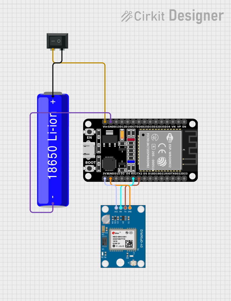
- Establish Communication: The module communicates via UART. Ensure the Raspberry Pi's UART interface is enabled.
- Access GPS Data: Use a serial communication tool or a Python script to read NMEA sentences (standard GPS data format) from the module.
Important Considerations and Best Practices
- Enable UART on Raspberry Pi: Use
raspi-configto enable the UART interface. Disable the serial console if it conflicts with the GPS module. - Antenna Placement: For optimal performance, ensure the GPS antenna has a clear view of the sky.
- Baud Rate: The default UART baud rate is 9600 bps. Ensure your software matches this setting.
- Power Supply: The module can operate on either 3.3V or 5V. Ensure the Raspberry Pi GPIO pins provide sufficient power.
Example Code for Raspberry Pi (Python)
Below is an example Python script to read GPS data from the L76K GPS HAT:
import serial # Import the serial library for UART communication
Configure the serial port for the L76K GPS HAT
/dev/serial0 is the default UART port on Raspberry Pi
gps_serial = serial.Serial('/dev/serial0', baudrate=9600, timeout=1)
try: while True: # Read a line of data from the GPS module gps_data = gps_serial.readline().decode('utf-8', errors='ignore').strip()
    # Print the raw NMEA sentence received from the GPS module
    print(gps_data)

    # Example: You can parse specific NMEA sentences (e.g., GPGGA) here
except KeyboardInterrupt: # Gracefully close the serial port on exit gps_serial.close() print("GPS reading stopped.")
Notes:
- Install the
pyseriallibrary if not already installed:pip install pyserial. - The script reads raw NMEA sentences. Parsing specific data (e.g., latitude, longitude) requires additional processing.
Troubleshooting and FAQs
Common Issues and Solutions
No GPS Data Output
- Cause: UART interface not enabled or serial console interfering.
- Solution: Use
sudo raspi-configto enable UART and disable the serial console.
Poor GPS Signal
- Cause: Antenna placement obstructed or indoors.
- Solution: Place the antenna outdoors or near a window with a clear view of the sky.
Incorrect Baud Rate
- Cause: Mismatch between the module's baud rate and the software configuration.
- Solution: Ensure the baud rate in your script matches the module's default (9600 bps).
Module Not Detected
- Cause: Loose connection or insufficient power.
- Solution: Check the GPIO connections and ensure the Raspberry Pi is supplying adequate power.
FAQs
Q1: Can I use the L76K GPS HAT with other microcontrollers?
A1: Yes, the module can be used with any microcontroller that supports UART communication. Ensure the voltage levels are compatible.
Q2: How do I increase the update rate?
A2: The update rate can be configured via specific NMEA commands sent to the module. Refer to the L76K datasheet for details.
Q3: Does the module support DGPS or SBAS?
A3: Yes, the L76K chip supports DGPS and SBAS for enhanced positioning accuracy.
Q4: Can I use the module indoors?
A4: While the module may work indoors, signal quality and accuracy will be significantly reduced. For best results, use it outdoors.
This concludes the documentation for the L76K GPS HAT. For further details, refer to the official Waveshare documentation or contact their support team.