Cirkit Designer Logo
Cirkit Designer
Your all-in-one circuit design IDE
Home / 
Component Documentation

How to Use M100-5883 GPS: Examples, Pinouts, and Specs

Image of M100-5883 GPS
Cirkit Designer LogoDesign with M100-5883 GPS in Cirkit Designer

Introduction

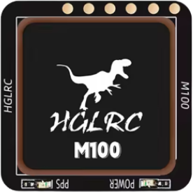
The M100-5883 GPS is a compact and high-performance GPS module manufactured by HGLRC. It is designed to provide accurate positioning and navigation data for a wide range of applications. With its low power consumption, high sensitivity, and fast time-to-first-fix (TTFF), the M100-5883 GPS is ideal for integration into drones, robotics, IoT devices, and other electronic systems requiring reliable location tracking.

Explore Projects Built with M100-5883 GPS

Use Cirkit Designer to design, explore, and prototype these projects online. Some projects support real-time simulation. Click "Open Project" to start designing instantly!
ESP32-Based GPS Tracker with OLED Display and Firebase Integration
Image of ecs: A project utilizing M100-5883 GPS in a practical application
This circuit is a GPS tracking system that uses an ESP32 microcontroller to read location data from a NEO-6M GPS module and display information on a 0.96" OLED screen. The system is powered by a 2000mAh battery with a lithium-ion charger, and it uploads the GPS data to Firebase via WiFi. Additional components include an MPU6050 accelerometer/gyroscope for motion sensing and a buzzer for alerts.
Cirkit Designer LogoOpen Project in Cirkit Designer
Solar-Powered GPS Tracker with ESP32 and TFT Display
Image of Project Hajj: A project utilizing M100-5883 GPS in a practical application
This circuit is a solar-powered GPS tracking system with a display. It uses multiple solar panels to charge two 2000mAh batteries via a LiPo battery charger module, which powers an ESP32 microcontroller, a GPS NEO 6M module, and an ILI9341 TFT display. The ESP32 reads GPS coordinates and displays them on the TFT screen, updating every 5 seconds.
Cirkit Designer LogoOpen Project in Cirkit Designer
Satellite-Based Timing and Navigation System with SDR and Atomic Clock Synchronization
Image of GPS 시스템 측정 구성도_Confirm: A project utilizing M100-5883 GPS in a practical application
This circuit appears to be a complex system involving power supply management, GPS and timing synchronization, and data communication. It includes a SI-TEX G1 Satellite Compass for GPS data, an XHTF1021 Atomic Rubidium Clock for precise timing, and Ettus USRP B200 units for software-defined radio communication. Power is supplied through various SMPS units and distributed via terminal blocks and DC jacks. Data communication is facilitated by Beelink MINI S12 N95 computers, RS232 splitters, and a 1000BASE-T Media Converter for network connectivity. RF Directional Couplers are used to interface antennas with the USRP units, and the entire system is likely contained within cases for protection and organization.
Cirkit Designer LogoOpen Project in Cirkit Designer
ESP32-Based GPS Tracker with OLED Display and Telegram Integration
Image of Yoon: A project utilizing M100-5883 GPS in a practical application
This circuit is a GPS-based tracking system that uses an ESP32 microcontroller to receive GPS data from a NEO 6M module and display the coordinates on a 1.3" OLED screen. It also features WiFi connectivity to send location updates to a remote server, potentially for applications such as asset tracking or navigation assistance.
Cirkit Designer LogoOpen Project in Cirkit Designer

Explore Projects Built with M100-5883 GPS

Use Cirkit Designer to design, explore, and prototype these projects online. Some projects support real-time simulation. Click "Open Project" to start designing instantly!
Image of ecs: A project utilizing M100-5883 GPS in a practical application
ESP32-Based GPS Tracker with OLED Display and Firebase Integration
This circuit is a GPS tracking system that uses an ESP32 microcontroller to read location data from a NEO-6M GPS module and display information on a 0.96" OLED screen. The system is powered by a 2000mAh battery with a lithium-ion charger, and it uploads the GPS data to Firebase via WiFi. Additional components include an MPU6050 accelerometer/gyroscope for motion sensing and a buzzer for alerts.
Cirkit Designer LogoOpen Project in Cirkit Designer
Image of Project Hajj: A project utilizing M100-5883 GPS in a practical application
Solar-Powered GPS Tracker with ESP32 and TFT Display
This circuit is a solar-powered GPS tracking system with a display. It uses multiple solar panels to charge two 2000mAh batteries via a LiPo battery charger module, which powers an ESP32 microcontroller, a GPS NEO 6M module, and an ILI9341 TFT display. The ESP32 reads GPS coordinates and displays them on the TFT screen, updating every 5 seconds.
Cirkit Designer LogoOpen Project in Cirkit Designer
Image of GPS 시스템 측정 구성도_Confirm: A project utilizing M100-5883 GPS in a practical application
Satellite-Based Timing and Navigation System with SDR and Atomic Clock Synchronization
This circuit appears to be a complex system involving power supply management, GPS and timing synchronization, and data communication. It includes a SI-TEX G1 Satellite Compass for GPS data, an XHTF1021 Atomic Rubidium Clock for precise timing, and Ettus USRP B200 units for software-defined radio communication. Power is supplied through various SMPS units and distributed via terminal blocks and DC jacks. Data communication is facilitated by Beelink MINI S12 N95 computers, RS232 splitters, and a 1000BASE-T Media Converter for network connectivity. RF Directional Couplers are used to interface antennas with the USRP units, and the entire system is likely contained within cases for protection and organization.
Cirkit Designer LogoOpen Project in Cirkit Designer
Image of Yoon: A project utilizing M100-5883 GPS in a practical application
ESP32-Based GPS Tracker with OLED Display and Telegram Integration
This circuit is a GPS-based tracking system that uses an ESP32 microcontroller to receive GPS data from a NEO 6M module and display the coordinates on a 1.3" OLED screen. It also features WiFi connectivity to send location updates to a remote server, potentially for applications such as asset tracking or navigation assistance.
Cirkit Designer LogoOpen Project in Cirkit Designer

Common Applications and Use Cases

  • Drones and UAVs for navigation and positioning
  • Robotics for autonomous movement and mapping
  • IoT devices for geolocation services
  • Vehicle tracking systems
  • Outdoor navigation devices

Technical Specifications

The M100-5883 GPS module is built to deliver reliable performance in a compact form factor. Below are its key technical details:

General Specifications

Parameter Value
Manufacturer HGLRC
Model M100-5883
GPS Chipset MTK3333
Frequency L1, 1575.42 MHz
Positioning Accuracy < 2.5 meters CEP
Time-to-First-Fix (TTFF) Cold Start: < 35s, Hot Start: < 1s
Sensitivity Tracking: -165 dBm, Acquisition: -148 dBm
Update Rate 1 Hz (default), up to 10 Hz
Operating Voltage 3.3V - 5.0V
Power Consumption < 50 mA @ 3.3V
Dimensions 18mm x 18mm x 6mm
Weight 5 grams

Pin Configuration and Descriptions

The M100-5883 GPS module has a simple pinout for easy integration into circuits. Below is the pin configuration:

Pin Number Pin Name Description
1 VCC Power supply input (3.3V - 5.0V)
2 GND Ground connection
3 TX UART Transmit (GPS data output)
4 RX UART Receive (for configuration commands)
5 SDA I2C Data Line (for compass functionality)
6 SCL I2C Clock Line (for compass functionality)

Usage Instructions

The M100-5883 GPS module is straightforward to use and can be integrated into a variety of systems. Below are the steps and best practices for using the module:

Connecting the M100-5883 GPS to an Arduino UNO

  1. Wiring the Module:

    • Connect the VCC pin of the GPS module to the 5V pin on the Arduino UNO.
    • Connect the GND pin of the GPS module to the GND pin on the Arduino UNO.
    • Connect the TX pin of the GPS module to the RX pin (Pin 0) on the Arduino UNO.
    • Connect the RX pin of the GPS module to the TX pin (Pin 1) on the Arduino UNO.
    • If using the compass functionality, connect the SDA and SCL pins to the corresponding I2C pins on the Arduino UNO.
  2. Installing Required Libraries:

    • Install the TinyGPS++ library for parsing GPS data.
    • Install the Wire library (built-in) for I2C communication if using the compass.
  3. Sample Code: Below is an example Arduino sketch to read GPS data from the M100-5883 module:

    #include <TinyGPS++.h> // Include TinyGPS++ library for GPS parsing
    #include <SoftwareSerial.h> // Include SoftwareSerial for UART communication
    
    // Define GPS module RX and TX pins
    SoftwareSerial gpsSerial(4, 3); // RX = Pin 4, TX = Pin 3
    TinyGPSPlus gps; // Create a TinyGPS++ object
    
    void setup() {
      Serial.begin(9600); // Initialize Serial Monitor
      gpsSerial.begin(9600); // Initialize GPS module communication
      Serial.println("M100-5883 GPS Module Test");
    }
    
    void loop() {
      // Read data from GPS module
      while (gpsSerial.available() > 0) {
        char c = gpsSerial.read();
        if (gps.encode(c)) { // Parse GPS data
          if (gps.location.isUpdated()) {
            // Print latitude and longitude to Serial Monitor
            Serial.print("Latitude: ");
            Serial.print(gps.location.lat(), 6);
            Serial.print(", Longitude: ");
            Serial.println(gps.location.lng(), 6);
          }
        }
      }
    }
    

Important Considerations and Best Practices

  • Ensure the GPS module has a clear view of the sky for optimal satellite reception.
  • Avoid placing the module near sources of electromagnetic interference (e.g., motors, power supplies).
  • Use a decoupling capacitor (e.g., 10 µF) between VCC and GND to stabilize the power supply.
  • If using the compass functionality, calibrate the compass in your application for accurate readings.

Troubleshooting and FAQs

Common Issues and Solutions

  1. No GPS Data Received:

    • Ensure the module is powered correctly (3.3V - 5.0V).
    • Verify the TX and RX connections between the GPS module and the microcontroller.
    • Check for a clear view of the sky to acquire satellite signals.
  2. Incorrect or No Location Data:

    • Wait for the module to acquire a fix (can take up to 35 seconds in a cold start).
    • Ensure the antenna is properly connected and oriented.
  3. Compass Not Working:

    • Verify the SDA and SCL connections for I2C communication.
    • Use a compatible library for reading compass data (e.g., Wire library).
  4. Intermittent GPS Signal:

    • Minimize interference by keeping the module away from high-frequency devices.
    • Use a ground plane or shielding to improve signal stability.

FAQs

Q: Can the M100-5883 GPS module be used indoors?
A: While the module can function indoors, GPS signal strength may be significantly reduced. For best results, use the module outdoors with a clear view of the sky.

Q: What is the default baud rate of the GPS module?
A: The default baud rate is 9600 bps.

Q: Can I increase the update rate of the GPS module?
A: Yes, the update rate can be configured up to 10 Hz using specific configuration commands sent via UART.

Q: Does the module support GLONASS or other GNSS systems?
A: No, the M100-5883 GPS module is designed to work with GPS satellites only.

Q: How do I calibrate the compass?
A: Calibration typically involves rotating the module in all three axes while collecting data. Refer to your application or library documentation for specific calibration procedures.